


Walnut Grove Voting District, Greene County, Missouri
About
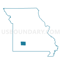
Outline

Summary
| Unique Area Identifier | 607935 |
| Name | Walnut Grove Voting District |
| County | Greene County |
| State | Missouri |
| Area (square miles) | 29.08 |
| Land Area (square miles) | 29.08 |
| Water Area (square miles) | 0.00 |
| % of Land Area | 100.00 |
| % of Water Area | 0.00 |
| Latitude of the Internal Point | 37.39160420 |
| Longtitude of the Internal Point | -93.55626740 |
Maps


Graphs
Select a template below for downloading or customizing gragh for Walnut Grove Voting District, Greene County, Missouri


Neighbors
Neighoring Voting District (by Name) Neighboring Voting District on the Map
- 1st Boone Voting District, Greene County, MO
- Cass Voting District, Greene County, MO
- Jackson Voting District, Polk County, MO
- Polk/North Morgan & South Morgan Voting District, Dade County, MO
- Polk/South & Smith R-4/Pilgrim & Rock Prairie Voting District, Dade County, MO
Top 10 Neighboring County Subdivision (by Population) Neighboring County Subdivision on the Map
- Walnut Grove township, Greene County, MO (1,452)
- Boone No. 1 township, Greene County, MO (1,426)
- Cass township, Greene County, MO (1,154)
- Rock Prairie township, Dade County, MO (980)
- Jackson township, Polk County, MO (864)
- Polk township, Dade County, MO (618)
Top 10 Neighboring Place (by Population) Neighboring Place on the Map
Top 10 Neighboring Unified School District (by Population) Neighboring Unified School District on the Map
- Ash Grove R-IV School District, MO (4,966)
- Marion County Early R-V School District, MO (3,938)
- Walnut Grove R-V School District, MO (1,930)
- Everton R-III School District, MO (1,195)
- Dadeville R-II School District, MO (960)
Top 10 Neighboring State Legislative District Lower Chamber (by Population) Neighboring State Legislative District Lower Chamber on the Map
- State House District 134, MO (48,531)
- State House District 139, MO (39,224)
- State House District 126, MO (36,895)
Top 10 Neighboring State Legislative District Upper Chamber (by Population) Neighboring State Legislative District Upper Chamber on the Map
- State Senate District 20, MO (222,813)
- State Senate District 32, MO (183,401)
- State Senate District 28, MO (177,259)
Top 10 Neighboring 111th Congressional District (by Population) Neighboring 111th Congressional District on the Map
Top 10 Neighboring Census Tract (by Population) Neighboring Census Tract on the Map
- Census Tract 9604, Polk County, MO (9,400)
- Census Tract 50.02, Greene County, MO (6,737)
- Census Tract 4801, Dade County, MO (4,736)
- Census Tract 50.01, Greene County, MO (3,564)